






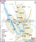
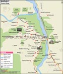
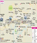
About
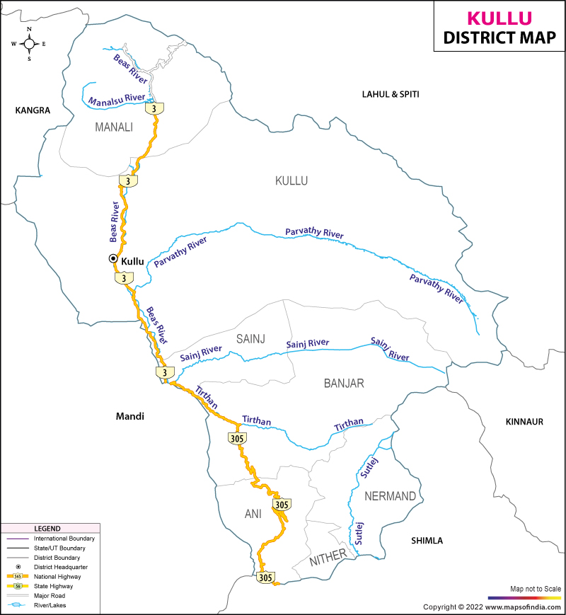
Among the steep peaks of the western Himalayas lies Kullu, cradled within Himachal Pradesh, molded by wild mountain beauty. Known as Dev Bhumi - Land of the Gods - its name whispers back to a forgotten phrase, Kulanth Peeth, hinting at boundaries beyond which habitation faded long ago . Once seen as the outer limit of human reach, travelers long believed emptiness followed beyond this lush stretch. After that boundary rose only vast mountains draped in endless snow. Along the clear waters of the Beas River lies this region, forming a route between Himachal’s flatlands and the icy expanses of Lahaul and Spiti. High above at nearly 1,279 meters sits Kullu, a quiet town where gentle climate meets the edge of rough terrain.
History & Culture
Home to myth, Kullu carries stories older than written time. From floodwaters, they say, Manu walked ashore right here - starting life again on soaked earth. That landing gave rise to Manali's name, meaning dwelling place of Manu. Old scripts like the Mahabharata speak of it often, tucked high in remote peaks. Not just land, but lore shaped these valleys through ages forgotten. Long ago, around the year one hundred, a royal figure named Behangamani Pal started the realm of Kullu. He came from Tripura, stepping into leadership through bloodline rather than conquest. Power stayed within his family for centuries, shifting slowly across strongholds - first resting at Jagatsukh, then rising among stone walls in Naggar. High above at nearly 1,279 meters sits Kullu, a quiet town where gentle climate meets the edge of rough terrain. Upward paths wind through thick pine forests until they hit jagged summits cloaked in permanent snow . His reason? To make up for serious wrongdoing. Upon arrival, he placed the god’s statue above all earthly rule, claiming only humility beneath its presence. From that day on, life and faith here moved differently. In Kullu, culture breathes through old customs still lived each day. Instead of modern councils, villages follow guidance said to come from their gods. Each settlement honors one main god, speaking through chosen spirit messengers called Gurs. At the heart of it all stands Kullu Dussehra - held wide open on the fields of Dhalpur Maidan - a gathering known far beyond the hills. On Vijayadashami, while most places light up Ravana’s figure, Kullu kicks off its festival. Down from highland homes come hundreds of ornate god statues, hoisted on wooden frames. These village gods travel to honor Lord Raghunath, arriving day by day. Deep roots show in how houses rise and clothes drape here. Built strong against shaking ground, Kath-Kuni homes stack wood and stone like woven threads - no cement needed. People carry heritage on their backs, wrapping themselves in thick handspun wool when cold winds climb down from the peaks. Bright stripes flash along the edges of Kullu Caps worn daily by many. Patterns bloom across Pattu shawls, tied close by.
Economy
Now shaped by both nature and effort, Kullu's economy once grew only from small farms high in the mountains. Today it pulses through many kinds of work, each tied closely to local landscapes. Driven less by tradition, more by adaptation, its path shifted slowly as people found new ways to thrive. Not just soil feeds this place anymore, but ideas too take root here. What began as survival now flows into varied trades, held together by resourcefulness.
Government Sector
Big dams rise where icy rivers rush through mountain valleys. State and national authorities shape development by building roads, running offices, feeding job markets, and funding local progress. Public ventures in green power push strong currents into the economy. Farms find support through state-backed studies, seed hubs, and weaving groups tied to village life. Officials pour resources into labs that test crops, centers growing saplings, collectives keeping traditional cloth alive. Rural balance leans on these quiet engines. Growth hums not just in cities but along terraced fields and river bends.
Public Sector
Stability begins where services reach far and wide. Banking branches stretch across regions, tied to affordable travel options - buses move people without high costs. Schools form a web of learning, steady and widespread. In villages, cooperatives open doors for weavers and farmers alike. Fair prices come easier when middle players fade away. Profits stay close, circulating where they’re earned.
Services Sector
These days, tourism along with fruit farming pushes growth more than anything else in Kullu’s job market. A big share of work now ties back to serving visitors or growing apples. Not long ago, most people relied on land differently. Now hotels, guides, and orchards shape much of daily life here. Shifts began slowly, then built up momentum through small changes adding up.
Tourism
Mountains cradle Kullu, where quiet retreats nestle beside rushing rivers. Not everyone arrives chasing snow peaks sharp against the sky. Some step into silence where incense curls around old stone steps. Quiet unfolds slowly near streams whispering under wooden bridges. You might hear bells hanging in wind, not engines roaring down trails. What feels distant becomes clear when breath fogs the morning light. Meaning appears without announcement beside a worn statue facing east. Time shifts when you stop counting miles. Manali started as a small market town where traders met long ago. Now streets hum with people sipping coffee in cozy cafes under eaves. Wooden walkways creak beneath feet wandering narrow alleys carved by time. From here, paths climb toward remote mountain crossings above the tree line. Buried deep among tall deodar woods near Manali, the Hidimba Devi Temple rises quietly - a 400-year-old structure built entirely of wood. High above, the roof rises step by step, folding into itself like steps meant for giants. Not far below, shapes curl along wooden arms, whispering stories without sound. She lived long ago - Hidimba - the fierce one tied to these slopes and ancient songs. Silence drapes heavy, lifted now and then by creaks of trees swaying slow. Time moves on, but the shrine lingers, tucked under leaves that never fall . High above, near the sky, Rohtang Pass rests at 3,978 meters - glaciers sprawl below, icy cliffs rise around. Instead of braving its sudden storms, travelers now slip through the Atal Tunnel - a feat carved deep beneath rock. This route, the longest of its kind above 10,000 feet, links Lahaul without pause, each season the same.
Out here, Kasol and the stretch of Parvati Valley pull travelers looking for slow mornings under tall pines, long walks through wild trails. Just a short move away sits Manikaran - spiritual ground shared by Sikh and Hindu visitors alike - where steam rises nonstop from natural geysers able to boil food on contact with their heat. Great Himalayan National Park is a UNESCO site that shelters life in thick forests where few footsteps reach. Rare animals find refuge here - snow leopards move like shadows through cold air. Birds such as the Western tragopan perch in high branches unseen. Bears roam freely across unbroken terrain. Protection keeps these spaces breathing, far from noise and change.
Demographics
Out here in Kullu, plenty keep old habits alive, thanks to strong reading skills and the slow beat of rural days. Even if new trends touch neighboring spots, life moves here much like it always has, held steady by mountain ways. Most people remain settled in villages where education spreads widely, yet change moves slowly. Kullu sits in the northern part of Himachal Pradesh, India. Back when census workers counted people in 2011, they recorded 437,903 residents living there. That number matters because it shapes how resources are shared across the state. Males made up 225,452 of that count, while females totaled 212,451. Because of its size and location, the area helps steer economic movement in the region. Governance here also influences nearby areas in quiet but steady ways. Females in Kullu outnumber males by less than a thousand, by fifty-eight. The balance between genders here lines up with or even beats India's overall mark. What you see is how society shapes up on the ground. Census after census, the makeup shifts - slow, steady, unseen. About seven out of ten people in Kullu can read and write, which reflects progress over time. While nearly nine in ten men have basic education, just over seven in ten women do - a noticeable difference between groups. Efforts continue at the local level to strengthen learning opportunities for everyone. One part of the region splits into six talukas, where local oversight happens through routine checks and records. Running through hills and plains, the land shifts under uneven crowds settling in separate zones
Languages Spoken
Most people here grow up speaking Kullui, a unique form within the Western Pahari group. Rooted in everyday life, it carries stories passed down aloud, along with songs shaped by time. When matters turn to paperwork, schools, or meeting travelers - so many arrive each season - Hindi takes over without effort. Communication shifts smoothly, depending on need.
Administration
Deep inside the hills, Kullu district runs on a clear layout of zones and community clusters, each watched over by the District Magistrate who works out of Kullu town. Though quiet in presence, the system keeps things moving without fuss, where oversight blends with routine order. From edge to center, boundaries shape how help travels and decisions land. Not loud but steady, authority follows structure like rivers follow valleys. Five main administrative parts divide the area, each managing land records along with revenue work. Seven tehsils operate under them, dealing also in local court issues. One step beyond routine tasks, these units keep daily governance running. Matters of ownership find resolution here, layered within regional oversight. Not just paperwork, but decisions flow through these offices regularly. On top of that, two unique areas go by the names Jari and Nitthar. These spots carry their own distinct setup within the region. Each one operates a bit differently than the rest.
| Facts of Kullu District | |
|---|---|
| Official Name | Kullu |
| Location | Himachal Pradesh |
| Area (km2) | 5503 |
| Population | 437903 (2011 census) |
| Language | Himachali, Hindi, Kanasi |
FAQs
Q1: What number of villages exist within Kullu district?
Spread through Kullu district, 441 villages sit within the official setup.
Q2: How many people live in Kullu district altogether?
Most folks here call small mountain villages home, tucked among high slopes. Back when census workers counted people in 2011, they recorded 437,903 residents living there.
Q3: Kullu District Known for what ?
Among mountain valleys, Kullu draws eyes worldwide with its lively International Kussa Dussehra fair. Rolling hills burst into rows of apple trees heavy with soft fruit. Locals craft fine woolen shawls on old wooden looms, thread by thread. Travelers often land here chasing views from Manali’s quiet lanes.
Last Updated on : August 18, 2026
