


About Maharashtra
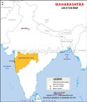
Located in the western part of India, Maharashtra is the third largest state in the country. The state covers an area of 3,07,713 sq. Km. Maharashtra shares its borders with the states of Gujarat, Madhya Pradesh, Chhattisgarh, Telangana, Karnataka, Goa.
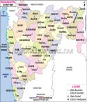
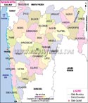
For administrative reasons, Maharashtra's 36 districts are organised into six revenue divisions: Nagpur, Konkan, Nashik, Aurangabad, and Amaravati. There is a long history of district-level planning statutory organisations in the state. In rural Maharashtra, 33 Zilla Parishads, 351 Panchayat Samitis, and 27,906 Gramme Panchayats are in charge of local self-governance.
The state which is home to one of the largest film industries of the world, i.e. Bollywood, also boasts of being the most significant contributor to India's National Industrial Output.
History of Maharashtra
Maharashtra's great past is determined by successive generations of influential administrations and cultural movements that moulded the character of this state. Archaeological discoveries reveal Maharashtra as a region dating to the 3rd century BC, as a state with great commercial and trading activities, mainly around Satara, an old port town beside modern Mumbai. In fact, the history of the region has Vakatakas, Rashtrakutas, Yadavas, whose rule made the state in its early days.
The influence of Islam began with the Khilji in the 13th century and the Tughlaqs and then the Bahmani Sultanate that ruled parts of Maharashtra until the Marathas would rise during the 17th century. Under Shivaji, the Maratha Empire would grow into a new challenge even to the Mughals. The influence of Marathi spread across India under Mughal pressure. Successors to Shivaji continued his legacy, but the empire reached its peaks under the Peshwas who managed the empire until the 19th century.
Post-independence, Maharashtra was united as one entity under one state in 1960 by the Bombay Reorganization Act when its historic journey came to a conclusion and converted to a modern entity. That blend of dynastic rule and resistance and cultural heritage defines Maharashtra's dynamic past and lasting legacy.
Following independence, the Bombay State was created adding some small princely states in Deccan and Kolhapur to the erstwhile Bombay Presidency. The Deccan States and Kolhapur were also included in the new state, but in 1960, the Bombay State was divided into Maharashtra and Gujarat.
Places to Visit in Maharashtra
Maharashtra has very diverse attractions of its own. The major attractions of the capital itself, Mumbai, are Gateway of India, Marine Drive, and Elephanta Caves. There exists Aga Khan Palace, Shaniwar Wada in Pune, where all the culture and history are personified. The hill stations will include Lonavala, Khandala, and Mahabaleshwar, featuring lush landscapes offering breathtaking views. In Aurangabad alone, stands the UNESCO-listed caves of Ajanta and Ellora, famous for ancient rock-cut temples. Wildlife buffs should visit Tadoba Andhari Tiger Reserve. For spirituality, Shirdi, Nashik's Trimbakeshwar Temple, and Siddhivinayak Temple in Mumbai attract pilgrims, making it a treasure trove of nature, history, and spirituality.
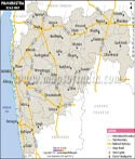
National Highways
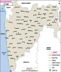
Several national and state highways pass through this state. A few of them are NH - 44, 47, 48, 50, 52, 53, 60, 61, 63, 65, 66, 130D, 150, 160, 160A, 160B, 160C, 160D, 160H, 161, 161A, 161E, 161G, 161H, 166, 166A, 166D, 166E, 166F, 166G, 166H, 247, 266, 347A, 347C, 348, 348A, 348B, 348BB, 353B, 353C, 353D, 353E, 353I, 353J, 353K, 361, 361B, 361C, 361F, 361H, 461B, 465, 543, 547, 547E, 548, 548A, 548B, 548C, 548CC, 548D, 548DD, 548E, 548H, 561, 561A, 647, 652, 752E, 752G, 752H, 752I, 752K, 753, 753A, 753AB, 753B, 753BB, 753C, 753E, 753F, 753H, 753J, 753L, 753M, 761, 848, 848A, 930, 930D, 953, 965, 965C, 965D, 965DD, and many more.
Best Time to Visit
Maharashtra is best visited between the months of October and March, during which time all the loveliness of weather conditions with cool comfort, makes the region ideal for city tours, hill stations, and ancient landmarks. This is the scenic period to visit Mumbai and Pune, coastal regions, as well as hill stations like Mahabaleshwar and Lonavala, as the temperatures are relatively mild, making them very refreshing. The monsoon months June to September are seasonally rich in verdure but heavy rainfalls can restrict outdoor activity and even traveling, particularly in coastal areas or regions where hills abound.
How to Reach
By Air
: Maharashtra is home to a plethora of airports, both local and international, making it an ideal destination for air travellers. Santa Cruz Domestic Airport, Chattarpati Shivaji International Airport, Aurangabad Airport, Shri Guru Gobind Singh Ji Airport, Dr. Babasaheb Ambedkar International Airport, and perhaps a few more. Major flights go to and from these airports, linking Maharashtra to other regions of India and the world.By Rail
: Being home to the Indian Central Railways headquarters, Chhatrapati Shivaji Terminus is regarded as the leading railway station in Maharashtra. Pune, Lucknow, Delhi, Kolkata, Chennai, and Bangalore are just a few of the cities in the nation that are connected to this railway station. Major railway stations in Nashik, Nagpur, Kolhapur, Aurangabad, Amravati, and Kolhapur are well-known for their connection. To go where you're going, just hail a taxi from here.By Road
: Roads also link the Indian state of Maharashtra to other urban areas. The cities of Delhi, Agra, Uttar Pradesh, Jaipur, and Ahmedabad are accessible by road. There are also easily accessible bus routes that go intrastate and interstate. One of two parties owns these buses: the government or private companies.Maharashtra State Information (as per maharashtra map) | |
|---|---|
| Capital | Mumbai |
| Date of formation | 1. May. 1960 |
| Governor | C. P. Radhakrishnan |
| Chief Minister | Shri Devendra Fadnavis |
| Tourist attractions | Gateway of India, Murud-Janjira Fort, Elephanta Island, Aurangabad Caves |
| Festivals | Makar Sankranti, Ganesh Chaturthi |
| Major dance and music forms | Vasudev Dance, Lavni Dance, Dhangari Gaja, Tamasha |
| Arts and crafts | People of the Warli tribe create ritualistic paintings on cow dung-plastered walls; Paithani saris; Mashru and Himroo fabrics |
| Languages | Marathi, English, Hindi |
| Area | 307,713 km2 |
| Population (Census 2011) | 112372972 |
| Rivers | Godavari, Penganga, Bhima, Varna, Parvara, Mula |
| Forests and wildlife sanctuaries | Pench NP, Tadoba NP, Nagzira National Park, Nawegoan NP, Devlagaon NP, Gugamal NP. |
| State animal | Giant squirrel |
| State bird | Yellow-footed green pigeon |
| State flower | Jarul |
| State tree | Mango |
| Major crops | Paddy, wheat, sugarcane, oranges |
| Factoids | Gharapuri, just outside Mumbai, has seven beautiful rock-cut caves carved between the 6th and 7th centuries AD. |
| Kolis were among the first residents of the archipelago or arc of seven islands that later became Mumbai. | |
| No. of Districts | 36 |
Maps in Other Regional Languages
MOI.AB.06.02.17
Last Updated on: May 12, 2026