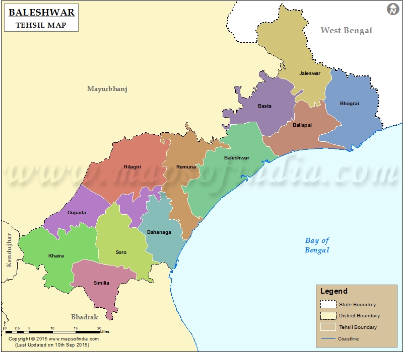
List of C.D. Block in Baleshwar District | ||
|---|---|---|
| C.D. Block/Police Station Name | Total : Rural + Urban Population (2001) in Number | Pin Code |
| Balaramgadi Marine | N.A | 756025 |
| Baleshwar (M) | 106,082 | N.A |
| Baleshwar Sadar (Pt.) | 172,937 | N.A |
| Baliapal | 151,786 | 756026 |
| Bampada | 18,800 | 756028 |
| Basta | 131,867 | 756029 |
| Berhampur | 48,592 | 756058 |
| Bhograi | 254,563 | 756038 |
| Chandipur | 42,838 | 756025 |
| Jaleswar | 127,877 | 756032 |
| Kamarda | N.A | 756035 |
| Khaira | 123,594 | 756048 |
| Nilagiri | 113,410 | 756040 |
| Oupada | 33,538 | 756049 |
| Raibania | 66,885 | 756033 |
| Remuna | 80,978 | 756019 |
| Rupsa | 22,320 | 756028 |
| Sahadev Khunta | N.A | 756001 |
| Similia | 141,484 | 756126 |
| Singla | 117,315 | 756023 |
| Soro | 269,642 | 756045 |
Last Updated on : March 24, 2020
|
|
