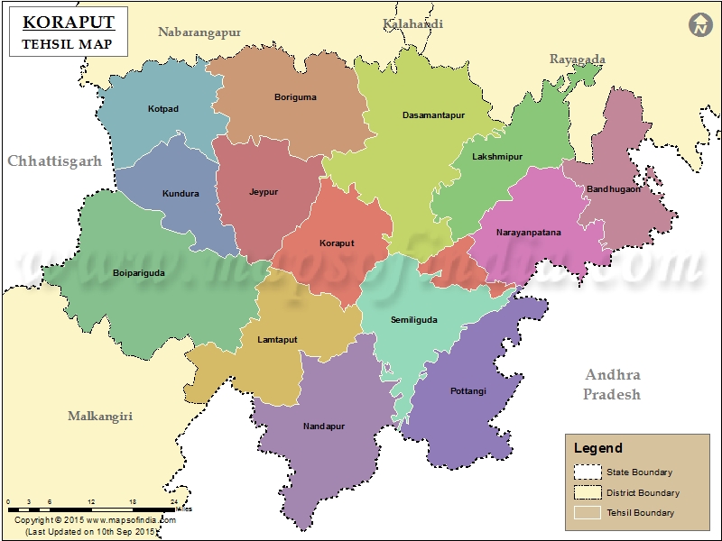
List of C.D. Block in Koraput District | ||
|---|---|---|
| C.D. Block/Police Station Name | Total : Rural + Urban Population (2001) in Number | Pin Code |
| Bandhugaon | N.A | 764027 |
| Bhairabsingipur | 59,622 | 764057 |
| Boipariguda | 103,576 | 764043 |
| Boriguma | 78,939 | 764056 |
| Damanjodi | 25,499 | 763008 |
| Dasamantapur | 44,348 | 764043 |
| Jeypur | 156,468 | 764001 |
| Kakiriguma | 21,488 | 765013 |
| Koraput | 60,190 | 764021 |
| Koraput Town | 45,798 | 764020 |
| Kotiya | N.A | 764039 |
| Kotpad | 103,975 | 764058 |
| Kundura | 47,073 | 764002 |
| Lakshmipur | 32,838 | 765013 |
| Machh Kund | 37,885 | 764040 |
| Nandapur | 63,621 | 764037 |
| Narayanpatana | 88,117 | 764014 |
| Padua | 49,544 | 764038 |
| Pottangi | 85,460 | 764039 |
| Similiguda | 16,442 | 764036 |
| Sunabeda | 59,754 | 763001 |
Last Updated on : March 24, 2020
|
|
