Last Updated on : May 11, 2026
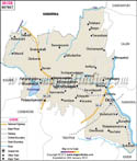
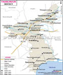
Thanjavur District Map |
|
||||||||||

| ||||||||||
|
| *The Map showing the National Highway, Major roads, other Roads, District Headquarter, Town, etc in the Thanjavur District, Tamil Nadu |
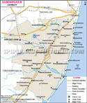
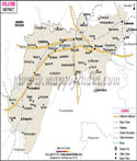
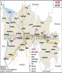
| Major Districts of Tamil Nadu |
 |
 |
 |
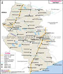 |
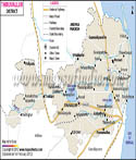
| Kanchipuram District Map | Vellore District Map | Salem District Map | Tirunelveli District Map |
 |
 |
 |
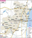 |
| Erode District Map | Tiruvallur District Map | Thanjavur District Map | Viluppuram District Map |
| other districts of Tamilnadu >> | |||
Last Updated on : May 11, 2026