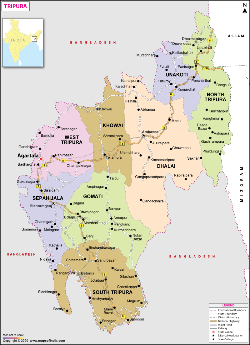
The chief occupation of the population in the state is agriculture. The principal crops are paddy, wheat, jute, sugar cane, potato, turmeric, coconut and oil seeds. Handloom weaving is the single largest industry in Tripura. Bamboo Handicrafts also make a major contribution to the state economy.
Some quality timber like Sal, Garjan, Teak, Gamar are found abundantly in the forests of the State. The service sector comprises only real estate, insurance and tourism industry.
Tripura State Information | |
|---|---|
| Capital | Agartala |
| Date of formation | 21. Jan. 1972 |
| Governor | Shri Indra Sena Reddy Nallu |
| Chief Minister | Manik Saha |
| Tourist attractions | Ujjayant Palace, Chaturdas Devata Temple, Neer Mahal, Sipahijala |
| Festivals | Kharchi Puja, Jer and Garia Puja, Ganga Puja |
| Major dance and music forms | Bihu dance, Sarinda, Sumui music |
| Arts and crafts | Bamboo mats; clothes with snakeskin designs known as Ponmongvom; garments called the risa and the rignai |
| Languages | Kok-borok, Bengali, Manipuri |
| Size | 10,486 sq. km |
| Population (Census 2011) | 3,673,917 |
| Rivers | Gomti |
| Forests and wildlife sanctuaries | Shepahijala WS, Trishna WS, Rowa WS |
| State animal | Phayre's langur or spectacled langur |
| State bird | Green imperial pigeon |
| State flower | Nageshwar |
| State tree | Agar |
| Major crops | Paddy, wheat, sugarcane, potato |
| Factoids | Singers are usually accompanied by instruments like the sarinda, chongpreng, bamboo flute or sumui. |
| Lake Rudrsagar is the only lake in eastern India with a palace in it; Neermahal was built by Maharaja Bir Bikram Kishore Manikya Bahadur as a summer resort. | |
| No. of District | 8 |
Last Updated on : January 14, 2026


