 |
|
|
 |
 |
|
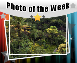
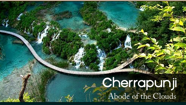
| Cherrapunji is a sub divisional town located in the East Khasi Hills of Meghalaya and is known to be the second wettest place in the world. Located at a distance of 60 km from the state capital of Shillong, Cherrapunji sits at an altitude of 4500 feet above sea level. |
|
 |
|
|
|
|
|
|
 |
|
| Tourist Attractions in Cherrapunji |
|
| Being situated in India�s north east, Cherrapuinji is blessed with abundant natural beauty, apart from that there are many interesting places for visitors to enjoy. Here are a few of them: |
|
|
|
|
|
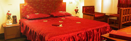
| Hotels and Accommodation |
|
 |
|
| Cherrapunji has quite a few places of accommodation right from budget to mid range to top end hotels, though it is advised to book a hotel in advance before reaching. Hotel prices are negotiable during the off season. In case of difficulty in finding accommodation in Cherrapunji it is advised for visitors to stay in Shillong, which is 60 km away from Cherrapunji. |
|
| |
 |
|
|
|
|
|
| How to Reach Cherrapunji |
|
| Here is how you can reach Cherrapunji: |
|
 |
|
| Rail |
| The nearest railhead to Cherrapunji is at Guwahati (Assam), which lies at a distance of 181 km from Cherrapunji. Guwahati railway station is very well connected to the rest of the country and one can hire a taxi or take a bus from here to reach Cherrapunji. |
|
|
 |
|
| Road |
| Cherrapunji is well connected by road and there are frequent bus services between Shillong and Cherrapunji. One can also share a taxi or a Sumo Maxi cab to get to Cherrapunji from Shillong or Guwahati. |
|
|
 |
|
| Air |
| The nearest airport to Cherrapunji is at Shillong, which is well connected to the rest of the country. Another convenient option is the Gopinath Bordoloi Airport at Guwahati, which is located 181 km from Cherrapunji. |
|
|
|
|
|
|
 |
|
|
|
|
|
|
|
|
A Business venture of Mapping Digiworld Pvt Ltd (An ISO 9001:2000 Certified Company)
C-62, Community Centre, Janakpuri, New Delhi - 58 (India) |
|
|
|
|
|