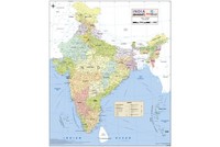
Current Rain Status |
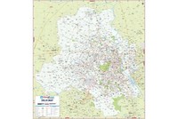
India Rainfall Map
In a country like India, where over half of the population is dependent on agriculture for their livelihood, rainfall holds special significance. The Indian Monsoon, also termed as the South West Summer Monsoon, falls between the months of June and September. The rainfall pattern observed in India is a result of an annual wind-driven weather practice causing more than three-fourth of annual rainfall. The southern part of India receives a greater amount of precipitation as compared to the northern region of the country.
The wettest places in the world like Mawsynram and Cherrapunji can be found in Meghalaya in India, yet the country has suffered drought-like conditions in the past years. In 2014 also, as per the Meteorological Department of India, the rainfall had a slow beginning with a dearth of about 42 per cent in the national cumulative average rainfall in June. The precipitation in the country from June 1 to June 25 was recorded as 74.4 mm, while the expected rainfall was 124.5 mm.
The deficiency of rain raises the temperature and elongates the spell of hot and humid summer in the country. In case, the situation worsens, it causes several disorders, including crop failure, inflation, decrease in the production of hydroelectricity, and fall in GDP, etc.
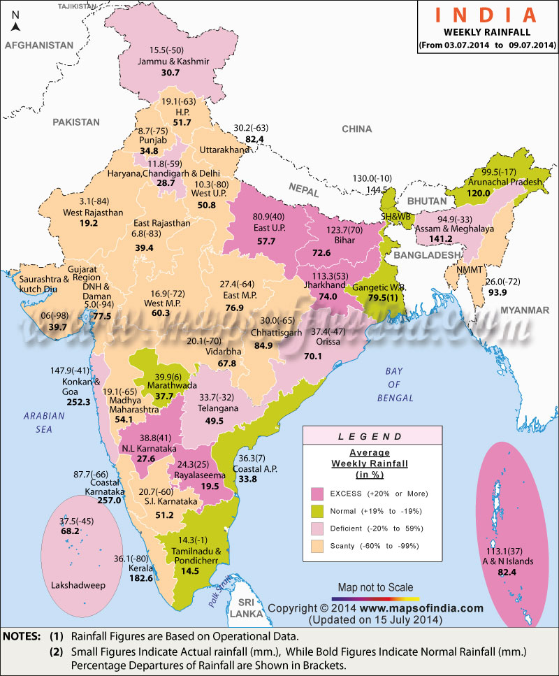
The India Rainfall Map here contains all the details about average weekly rainfall occurring in various states of the country. Different colours on the map will help you identify regions with excess, normal, deficient and scanty rainfall.
Reference: Indian Meteorological Department (IMD)
WBMA170714