Kakinada District Map


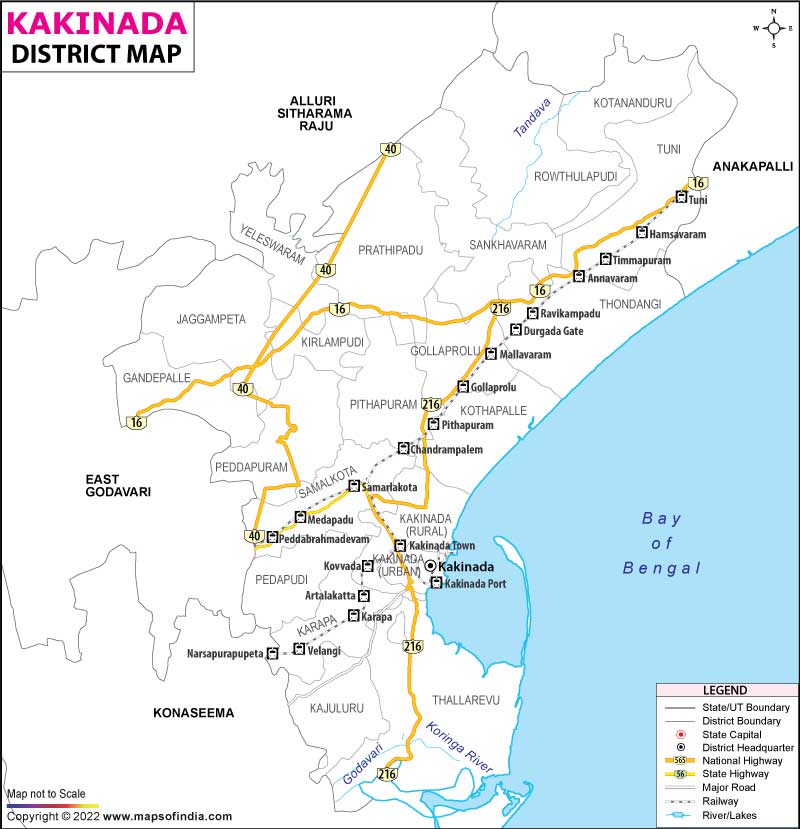
District Map of Kakinada

separator Click here for Customized Maps arrow custom map
District Map of Kakinada
Print Email Save Buy Now 
*Kakinada District Map highlights the National Highway, Major Roads, District Headquarter, etc in Kakinada. Disclaimer


  Major Districts of Andhra Pradesh  
Anantpur District Map Guntur District Map East Godavari District Map Chittoor District Map
Anantpur District MapGuntur District MapEast Godavari District MapChittoor District Map
    
Prakasam District Map Krishna District Map Kurnool District Map Vishakhapatnam District Map
Prakasam District MapKrishna District MapKurnool District MapVishakhapatnam District Map
 
  Other Districts of Andhra Pradesh >>

The recently created district of Kakinada has borders with the East Godavari district to the south and the districts of Anakapalli and Alluri Sitaramaraju to the north. East of the Bay of Bengal and South of Konaseema District.

Two revenue divisions have their headquarters at Peddapuram, Kakinada. The District consists of 21 Mandal Parishads and 21 Revenue Mandals. In the District, there are 385 Gram Panchayats. Two Nagar Panchayats, namely Yeleswaram and Gollaprolu, as well as four municipalities—Samalkot, Pithapuram, Peddapuram, and Tuni—as well as one municipal corporation—Kakinada—are present.


Last Updated on : December 26, 2022