|
||||||||
 | ||||||||
|
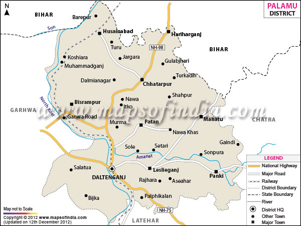
| *Palamau District Map highlights the National Highways, Major Roads, District Headquarter, etc. |
| PALAMU DISTRICT PROFILE | |
|---|---|
| COUNTRY | INDIA |
| STATE | JHARKHAND |
| AREA | 5,044 sq km |
| DISTRICT HEADQUARTERS | Daltonganj |
| ASSEMBLY SEATS | 5 |
| POPULATION | |
| Total | 1936319 |
| Male | 1003876 |
| Females | 932443 |
| Density/km2 | 381 |
| Sex Ratio | 929 |
| LITERACY RATE (% age) | |
| Male | 76.27 |
| Females | 53.87 |
Last Updated on : 26th March 2013
|
|