
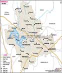
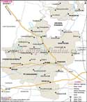
Mysore occupies an area of 6,268 sq. km. The total population of this district is 22,81,653, according to the census of 1991.
The sites for tourist attraction are
- Mysore Palace
- Chamundi Hill
- St.Philomena's Church
- Jaganmohana Palace
- Somanathapura
Mysore District Map |
|
||||||||||||

| ||||||||||||
|
| *District Map of Mysore highlights national highway, major roads, railways, rivers, etc. | Disclaimer |
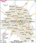
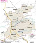
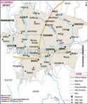
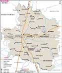
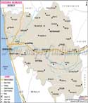
| Major Districts of Karnataka |
 |
 |
 |
 |
| Bangalore District Map | Belgaum District Map | Gulbarga District Map | Shimoga District Map |
 |
 |
 |
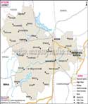 |
| Tumkur District Map | Bijapur District Map | Dakshin Kannad District Map | Mysore District Map |
| other districts of Karnataka >> | |||
|
|