Kasargod District Map |
|
||||||||||||

|
||||||||||||
|
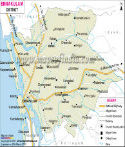
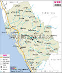
| *Map showing national highway, major roads, district headquarter, etc in Kasaragod District of Kerala. | Disclaimer |
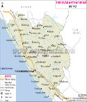
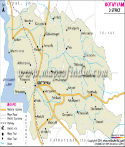
| Major Districts of Kerala |
 |
 |
 |
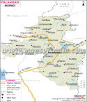 |
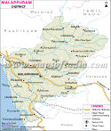
| Ernakulam District Map | Malappuram District Map | Kollam District Map | Palakkad District Map |
 |
 |
 |
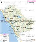 |
| Kannur District Map | Thiruvananthapuram District Map | Kottayam District Map | Kozhikode District Map |
| other districts of Kerala >> |
The total area of Kasaragod is 1,992 sq. km. According to the census of 2001, the total population of Kasaragod is 12,03,342 , out of which 5,87,763 comprises the male population and 6,15,579 the female population. The density of population is 604 per sq km.
The popular tourist sites in Kasaragod are
- Adoor
- Ajanoor
- Ananthapura Lake Temple
- Chandragiri Fort
- Kanwatheertha Beach Resort
- Trikkanad and Pandyan Kallu
Last Updated on : 18 October 2018
|
|