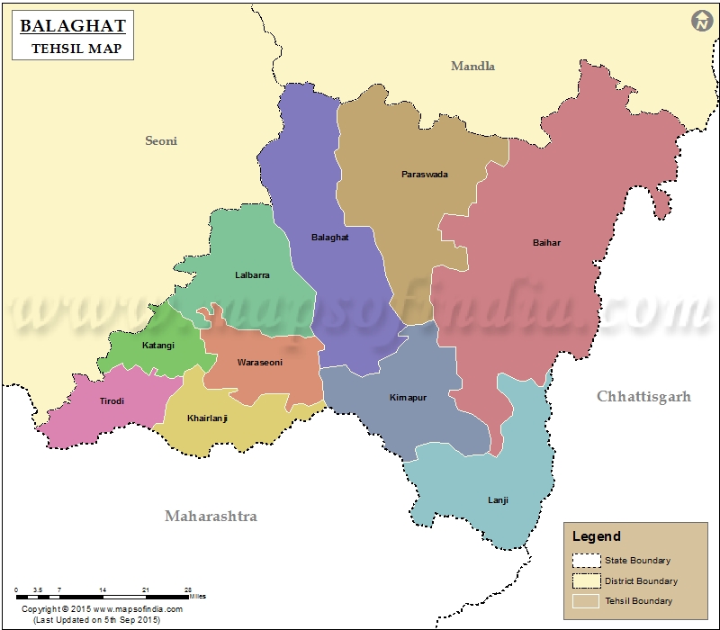
List of Tehsils in Balaghat District | ||
|---|---|---|
| Taluk Name | Total (Rural + Urban) Population (2001) in Number | Pin Code |
| Baihar | 337,182 | 481111 |
| Balaghat | 236,605 | 481001 |
| Katangi | 166,353 | 481445 |
| Khairlanji | N.A | 481337 |
| Kirnapur | 154,407 | 481115 |
| Lalbarra | N.A | 481441 |
| Lanji | 159,576 | 481222 |
| Paraswada | N.A | 481556 |
| Tirodi | N.A | 481449 |
| Waraseoni | 443,845 | 481331 |
Last Updated on : September 10, 2015
|
|
