|
||||||||||||
 | ||||||||||||
|
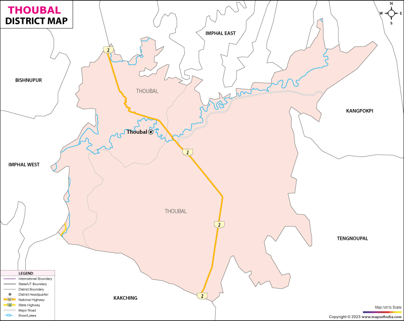
| *Thoubal District Map highlights the National Highways, Major Roads, District Headquarter, etc in Thoubal . | Disclaimer |
Thoubal district is synonymous with a triangular shaped valley that occupies more than half of the eastern region of the state. The district encompasses an area of 517 sq. km and stretches between the latitudinal parallels extending between 23° 45' North and 24°45' North and the longitudinal meridians of 93°45' East and 94°15' East.
The district is enclosed between the districts of Imphal, Chandel, Ukhrul, Churchandpur and Bishnupur and is sited at an elevated altitude of 790 m above mean sea level.
The topography is a wonderful medley of hills and knolls as well as undulating plains that are laced by several rivers and dotted by sylvan lakes that gleam like a mirage of quicksilver. The district is drained by the Imphal and Thoubal rivers while the Kharung, Ikop,Waithou, Pumlen, Lousi and Ngangou Lakes shimmer prettily and adorn the landscape like a jewel in a brass setting.
Thoubal district's claim to fame rests in its gory history of the carnage of the Myanmar war. The district, carved out from the erstwhile Manipur Central District, came into existence officially in May 1983. The principal towns of Thoubal include the following:
According to the 2001 census report, Thoubal district records a population of 41, 1149. The economy is predominantly agrarian and is supplemented by the tribal people who also practice animal husbandry, fishing and also other allied industries.
The topography is a wonderful medley of hills and knolls as well as undulating plains that are laced by several rivers and dotted by sylvan lakes that gleam like a mirage of quicksilver. The district is drained by the Imphal and Thoubal rivers while the Kharung, Ikop,Waithou, Pumlen, Lousi and Ngangou Lakes shimmer prettily and adorn the landscape like a jewel in a brass setting.
Thoubal district's claim to fame rests in its gory history of the carnage of the Myanmar war. The district, carved out from the erstwhile Manipur Central District, came into existence officially in May 1983. The principal towns of Thoubal include the following:
- Shikhong Sekmai
- Yairipok
- Kakching Khunou
- Sugnu
- Thoubal
- Lilong
- Wangjing
- Kakching
- Heirok
According to the 2001 census report, Thoubal district records a population of 41, 1149. The economy is predominantly agrarian and is supplemented by the tribal people who also practice animal husbandry, fishing and also other allied industries.
Last Updated on : January 16, 2023
|
|