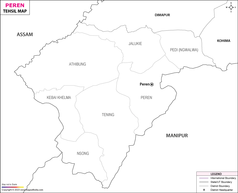
Peren Tehsil Map


Tehsil Map of Peren

separator Click here for Customized Maps arrow custom map
Tehsil Map of Peren Dimapur Kohima MANIPUR ASSAM
Print Email Save Custom map available for purchase, showcasing unique designs tailored to individual preferences and locations Buy Now 
*Map highlights the name and location of all the tehsils in Peren district, Nagaland. Disclaimer


List of Taluks in Peren District

Circle/Taluk NameTotal : Rural+Urban Population (2001) in NumberPin Code
Athibung12,310797110
Jalikie23,274797110
Kebai KhelmaN.A797110
Nsong8,171797101
Pedi ( Ngwalwa )8,411N.A
Peren8,861797101
TeningN.A797101


Last Updated on : January 30, 2023