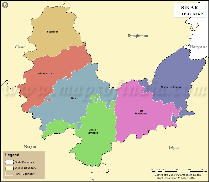
List of Tehsils in Sikar District | ||
|---|---|---|
| Tehsil/Taluk Name | Total (Rural + Urban) Population (2001) in Number | Pin Code |
| Danta Ramgarh | 358,581 | 332703 |
| Fatehpur | 261,071 | 332301 |
| Lachhmangarh | 283,689 | 332311 |
| Neem-Ka-Thana | 346,597 | 332713 |
| Sikar | 530,871 | 332001 |
| Sri Madhopur | 506,979 | 332715 |
Last Updated on : February 4, 2020
|
|
